Map your dirt time.
Outdoor adventure mapping for the trail-curious. Pin photos, plot GPX tracks, layer in trails and parks, and share the whole trip with friends.
The map, live
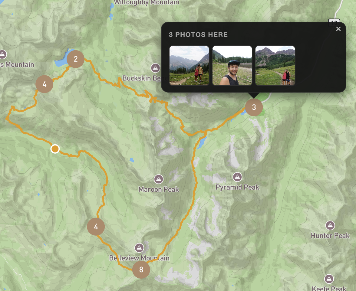
Pan and zoom Moab. Each teal pin is a real photo a dirtplease user shared publicly — click any one to open it.
Every place you've put boots down
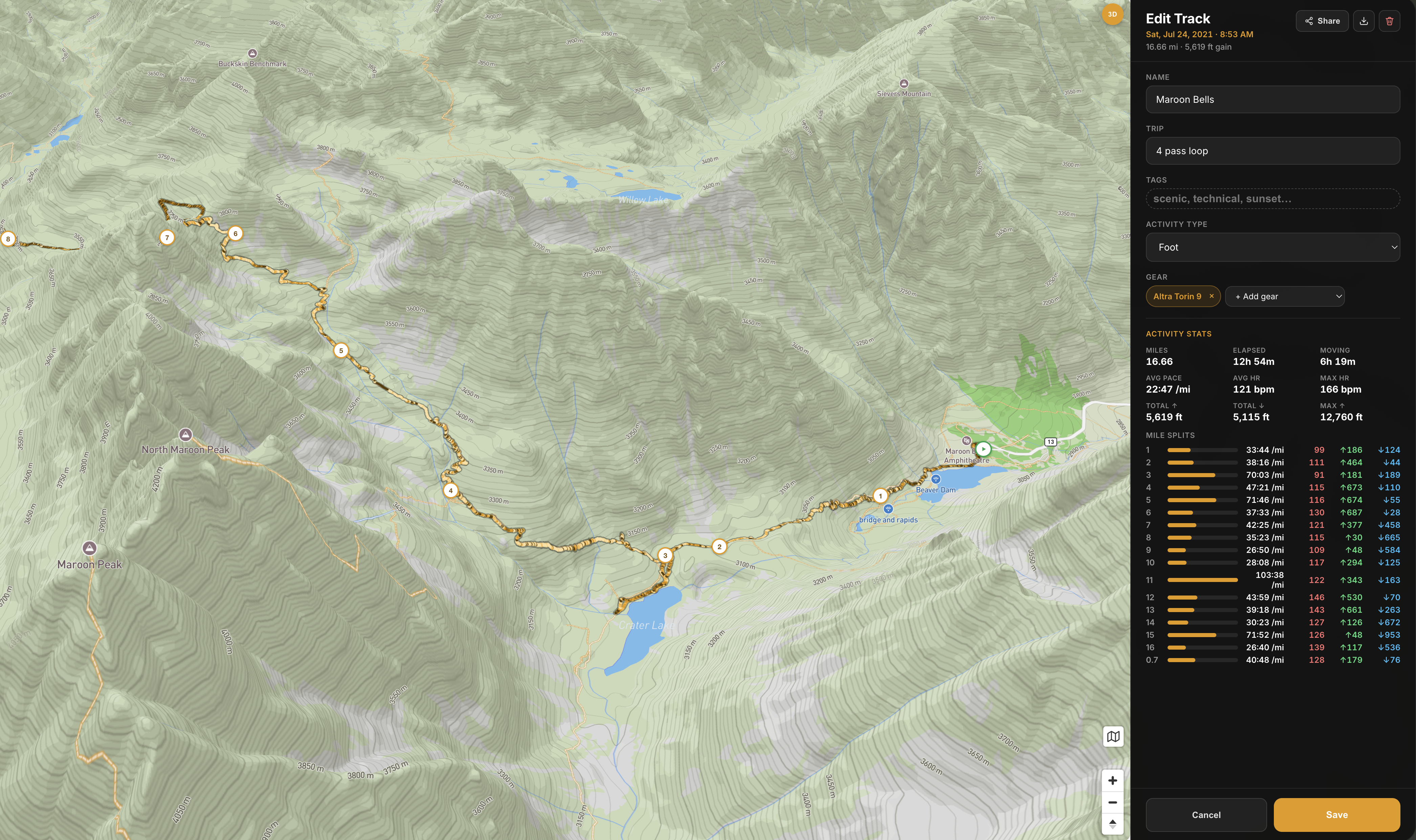
Your routes and photo clusters layered together on the terrain. Zoom out to see the whole year of dirt time at a glance, or zoom in to wander through every spot.
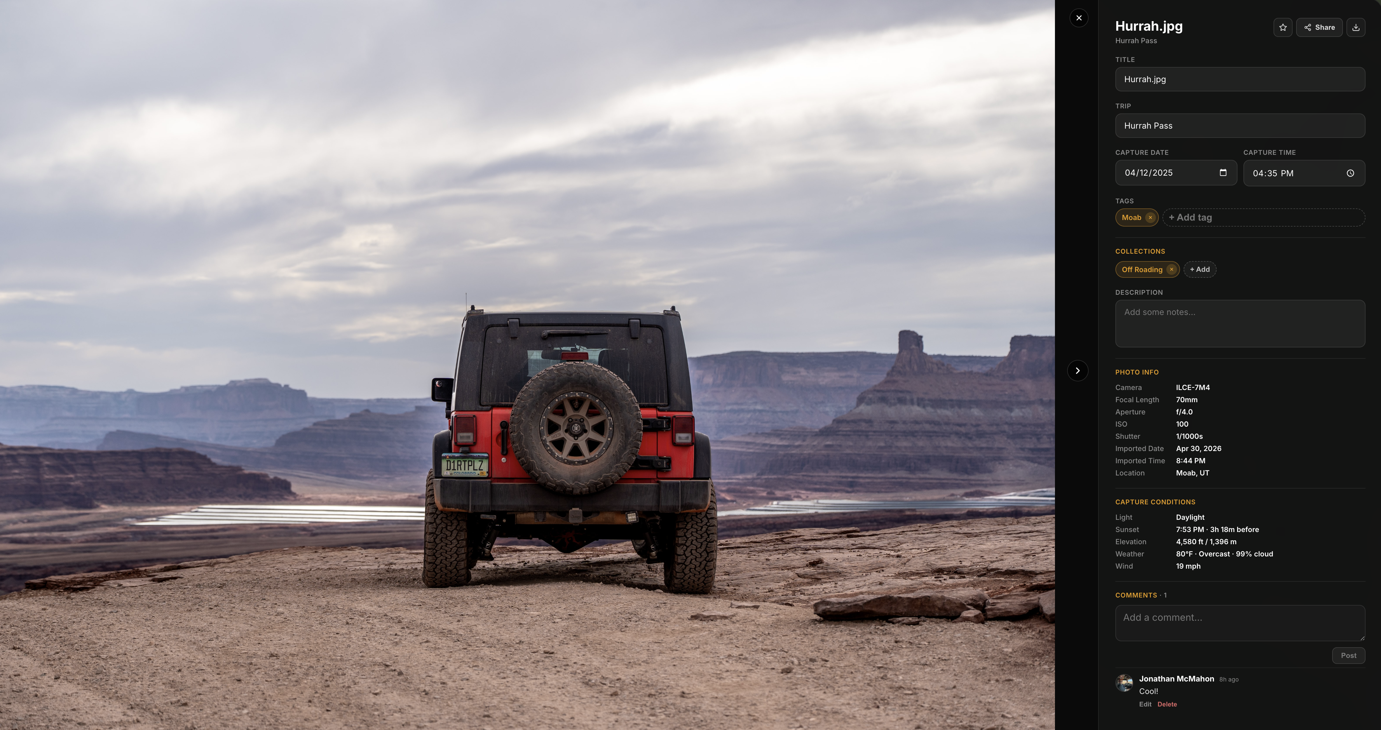
Photos turn into places
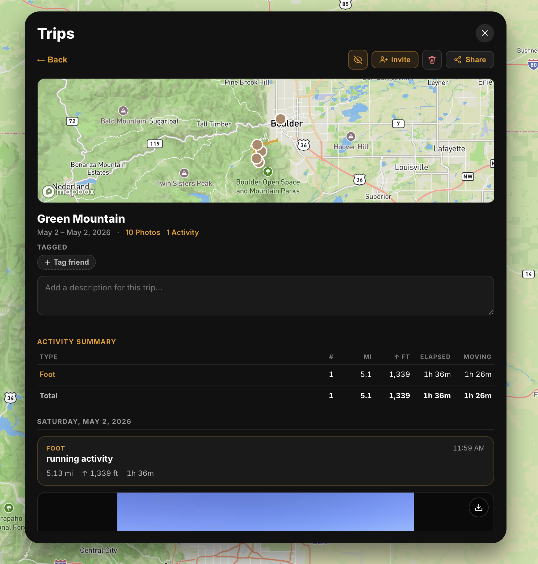
Drop in a folder of photos and we'll pin them to the map from their GPS data. Group them into trips, tag the friends who came along, and write up what you got into.
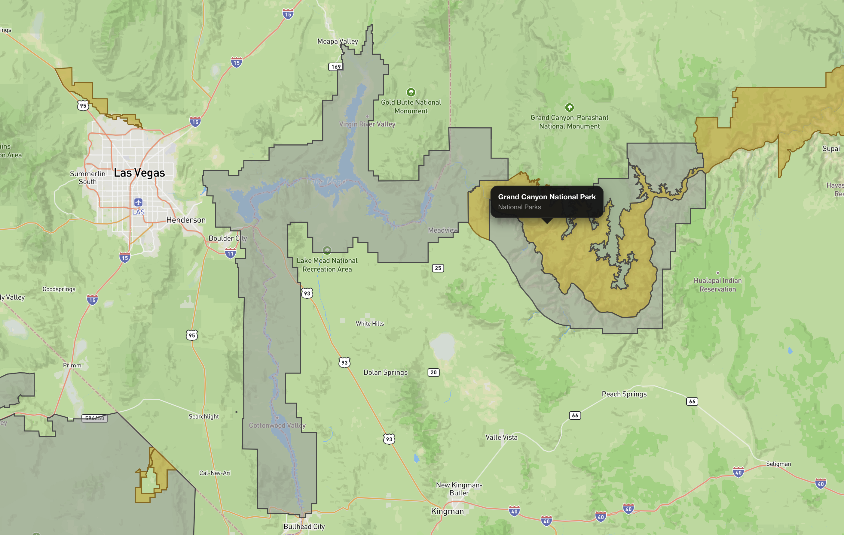
Way more than a basemap
Toggle in National Parks, Forest Service trails, iconic trails, motor vehicle use maps, BLM land — over a dozen overlays for off-trail planning that no consumer map app gives you.
Browse what others have mapped
Public trips from real dirtplease users — pan their photos on the map, or open a trip to see the full story.
Discover public trips →Bag the list, on the map
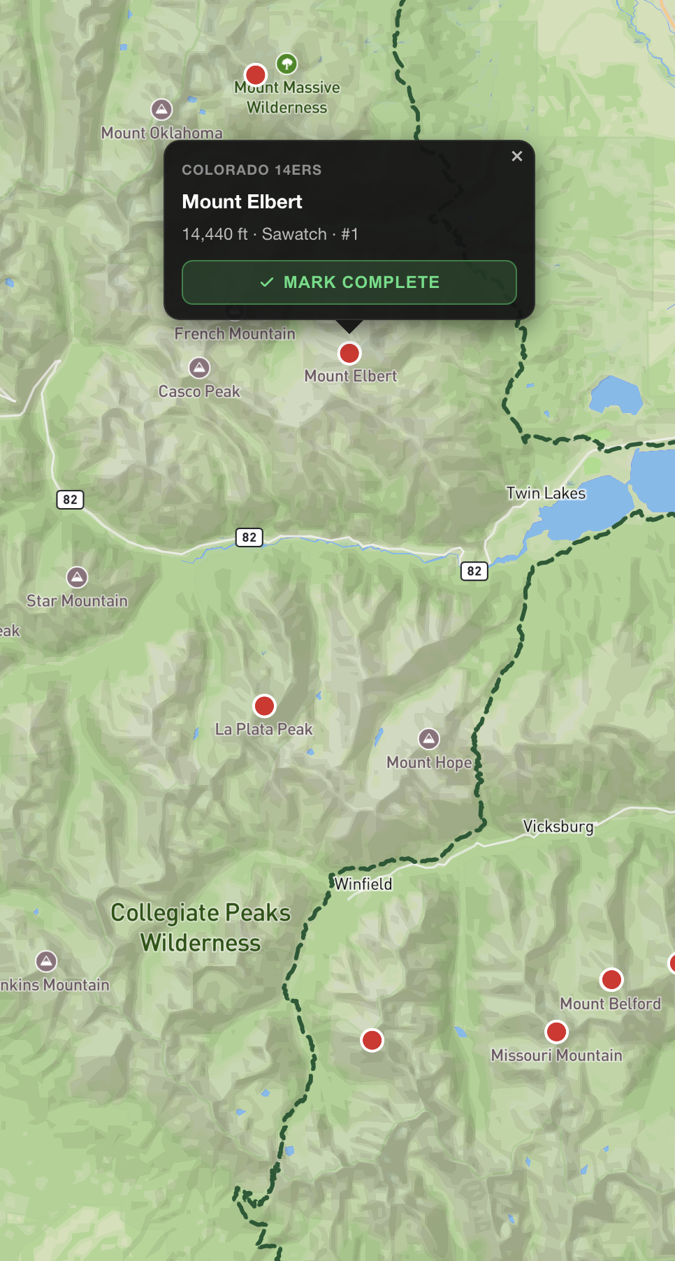
The Colorado 14ers, Adirondack 46, your own bucket list — tap a pin on the map to mark it complete.
Ready to map your dirt time?
Free to use. Drop your first photo and watch it land on the map.